
Carrollton ZIP Code Coverage
Four ZIP codes have verified residential Carrollton use: 75006, 75007, 75010, and 75019. Each is a postal geography, not a city neighborhood or county label. A complete address must still be checked because the same ZIP can extend beyond corporate limits or serve a nearby community. The table keeps the postal labels separate from parcel and city-boundary research, which matters in a city that spans Dallas, Denton, and a smaller Collin County portion.
| ZIP | Carrollton area use | Post office or route | Research note |
|---|---|---|---|
| 75006 | Central and south Carrollton, including Dallas County-side addresses and corridors | Carrollton Post Office | Postal area does not establish the county. |
| 75007 | North and central Carrollton, including Denton County-side addresses | Rosemeade Station route | Use the full address before routing a parcel. |
| 75010 | Far-north Carrollton and nearby Lewisville/Plano-area postal territory | Rosemeade Station route | Extends beyond the Carrollton city line. |
| 75019 | West and northwest Carrollton with Coppell-area postal territory | Coppell-area delivery, station varies | Do not derive city limits or county from the postal label. |
| 75011 | Carrollton mailing, business, or special postal service use | Carrollton Post Office association | Treat as special or PO-box use until an address-level USPS result confirms delivery type. |
The Carrollton Post Office at 2030 E. Jackson Road is associated with 75006 and 75011 service, while Rosemeade at 3755 N. Josey Lane is listed as a nearby or alternate station for 75007. Those station details are helpful for postal routing, yet they do not settle a parcel’s governmental jurisdiction.
Verify a Carrollton ZIP Code First
The USPS ZIP Code Lookup is the source for a complete address. Use its address, city-and-state, or Cities by ZIP modes to obtain the standardized ZIP and ZIP+4 where the tool supplies it. The USPS result does not confirm that a particular person or organization is at that address. It verifies postal addressing, which is why it belongs at the start of a record search rather than the end.
For a postal-service question, the Carrollton Post Office location page provides the Carrollton office, phone, hours, and services, and identifies Rosemeade as an alternate or nearby station. A counter or phone contact may clarify mail service, but only the rendered address result should be used to classify a complete delivery address. The research did not locate an official USPS table proving every 75011 delivery type, so the cautious treatment in the coverage table should remain in place.
Source view: the USPS Carrollton Post Office page shows the official location route used to confirm postal service details.
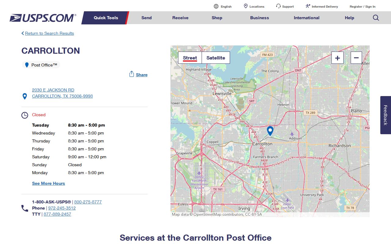
The USPS view supports address verification, while county and parcel facts come from the appraisal, clerk, and map systems.
Carrollton ZIP Code Directory Terms
Postal terms can look like property terms even though they serve different systems. A ZIP code helps direct mail. The appraisal district uses a situs address and parcel account. The county clerk follows the legal description in deeds and plats. Keeping those fields distinct prevents a postal result from being treated as a title record, a voter record, or proof of who occupies a property.
- ZIP code
- A postal delivery area used to route mail. It is not a municipal or county boundary.
- ZIP+4
- An added postal segment that refines delivery for a complete address. It is not a parcel identifier.
- PO-box or special ZIP
- A ZIP used for a postal service arrangement rather than evidence of ordinary residential delivery.
- Carrier route
- A postal delivery grouping. It can cross neighborhood, city, or county lines.
- Situs address
- The physical location used by CAD, GIS, permits, and code records, distinct from a mailing address.
For older research, the address field may not use a modern ZIP at all. A parcel can be described by an addition, lot and block, abstract or survey. That legal description is the bridge from a historic document to a current map.
Find Carrollton Records Within One ZIP
A ZIP code narrows a search, but most local record portals remain address or parcel based. Denton taxweb captures owner mailing address and property location, not an obvious ZIP-only field. Dallas and Collin CAD address modes may accept street and ZIP through their rendered controls, but the exact ZIP behavior must be checked in the live portal. GIS tools locate addresses and parcels, then display districts and boundaries. They are not a ZIP-wide resident list.
- Enter the full street address in the USPS tool and record the standardized ZIP and ZIP+4 if returned.
- Use the city map, GIS viewer, or CAD address search to identify the parcel county and the correct appraisal district.
- Search the CAD by property location, account, owner, or map, using the ZIP only as an address aid where the system accepts it.
- Carry the parcel account and legal description to the county clerk if a recorded deed or plat is needed.
- Use the county elections route for voter matters and treat ZIP as a prompt to verify the county and precinct, not as the filter for a public roster.
Once the ZIP has narrowed a location to an actual street, the Carrollton street directory gives the address-first record sequence. That handoff matters because a postal route cannot replace the parcel, owner, and deed fields used in local records.
Carrollton ZIP Searches Need Address Fields
Use the field that fits the source rather than forcing a ZIP into every form. Denton taxweb distinguishes the owner’s mailing address from the physical property location and directs users to omit street type and direction for a property-location search. Dallas CAD supports owner name, account number, street address, business name, and map modes. Collin CAD adds fields such as street number, street name, subdivision, neighborhood, tax year, and legal description. These are the practical fields that turn a ZIP clue into a parcel search.
| Portal or tool | Observed search fields or controls | ZIP caution |
|---|---|---|
| Denton taxweb | Account number, owner name, owner address, property location, account type, active/inactive, paid/unpaid | Property location is the physical-address route; no clear ZIP-only field was captured. |
| Dallas CAD | Owner, account, street address, business name, map | Use a full address and map result, then confirm county. |
| Collin CAD | Owner, street number, street name, subdivision, neighborhood, legal description, tax year | Advanced controls help confirm a parcel, not a postal boundary. |
| Denton GIS | Interactive maps, downloads, parcel/precinct/district context | Map layers orient an address; ZIP is not a title key. |
Source view: the Denton County GIS hub links the map, downloads, and precinct-by-address resources used after a Carrollton address has been normalized.
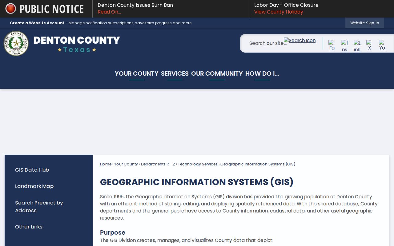
The GIS hub adds parcel and district context, then the county CAD or clerk can supply the record-specific follow-up.
Carrollton ZIP Codes Cross Three Counties
Carrollton’s city charter recognizes territory in Dallas, Denton, and Collin counties. A Carrollton postal city on an envelope therefore does not tell a researcher which clerk holds the deed, which CAD has the card, or which registrar maintains a voter record. The City of Carrollton map collection provides planning, zoning, election, parks, and school maps, and it directs raw GIS-data requests through the City Secretary. Use it with the county parcel layer and USPS address result, not instead of either one.
This is the page’s most important geography rule: postal city, municipal city, county, and Census ZIP Code Tabulation Area are distinct fields. A ZCTA is a statistical approximation, not a USPS delivery boundary. A city-limit parcel may use a neighboring postal city, and a Carrollton-branded mailing address may belong to a parcel outside city limits. Record the result in separate columns when comparing a group of addresses.
Boundary check. Verify a complete address with USPS, then use the county parcel map to identify Dallas, Denton, or Collin custody before requesting records.
Carrollton Addresses Before ZIP Codes
Historic Carrollton records often predate modern postal coding. The first local post office opened in 1878, the Myers brothers’ 1900 plat shaped the Town Square, and the interurban began service in 1922. Older deeds, newspapers, and directories can describe a depot, square, railroad, farm, church, school, survey, or addition rather than a ZIP or modern subdivision. That history is useful when a present-day ZIP search cannot locate a record.
Use the lot, block, survey or abstract, nearby roads, historic map, and directory street guide to bridge the old reference to the current parcel. Carrollton Library’s Texas Digital Sanborn Maps access provides a useful building and street-context source, though a Sanborn sheet is not a resident roll. The research found no official citywide ZIP-split, street-renumbering, or renaming chronology. Avoid silently matching two street numbers merely because their postal city is Carrollton.
Note: A historic landmark or addition name can be a better search key than a modern ZIP when working with an early record.
Carrollton ZIP Boundaries and City Limits
ZIP boundaries do not track city limits, county lines, precincts, or recorded plats. A 75010 or 75019 address can reach territory beyond Carrollton, while an address inside Carrollton may have a postal-city label that seems to point elsewhere. The right conclusion is modest: the ZIP is a delivery clue. The city map identifies municipal context, GIS and CAD identify the parcel, and the county clerk identifies recorded land documents.
When a record search fails, remove an added ZIP, unit, direction, or street type only after writing down the original complete address. Search the street number and name in the right CAD, then use the account number or legal description. If a portal still does not expose the needed data, contact the county custodian or send a defined Texas Public Information Act request for city-held GIS or permit material. The public body is not required to create a new analysis, but it can route a properly described records request.