
Carrollton Neighbors by Public Source
Each public source answers a smaller question about Carrollton neighbors. A parcel map shows spatial adjacency. An appraisal card shows the assessed owner and public parcel fields. A deed or plat adds recorded transfer and subdivision context. Voter evidence is person-specific and constrained by Texas privacy rules. Association pages provide a public contact structure or event information, not a city-maintained membership roster. Keeping those boundaries visible avoids turning a map observation into a claim about who lives at an address.
| Source | What it shows around a block | Access route |
|---|---|---|
| GIS or CAD map | Parcel edges, adjacent lots, map layers, and account links | Free public map with accuracy disclaimer |
| CAD or tax card | Assessed owner, mailing and situs address, values, exemptions | County-specific public portal |
| Deed or plat | Recorded transfer, lot and block, legal continuity, subdivision detail | County clerk index, counter, or copy request |
| Voter status or file | A named person’s public status and precinct where available | SOS portal or formal county/precinct request |
| CityServe | Permit, planning, or code items tied to a site address | Portal or defined city records request |
| Association pages | Public contact, boundary, events, or block-captain structure | Association or city partnership contact |
Owner and occupant are not interchangeable. A parcel can be jointly owned, held by an entity, vacant, or used as a common area, drainage tract, or right-of-way. A mailing address can differ from the physical parcel. An exemption can be a useful occupancy signal, but it cannot establish every person connected with the address.
Map Carrollton Neighbors with GIS
The dependable sequence for Carrollton neighbors is GIS to CAD to clerk. Start with the target address in the map for the parcel county. Denton County provides the Landmark Interactive Map and GIS hub, while the Dallas CAD Property Map accepts an account, property address, owner name, current location, or map click. Collin-side parcels need the Collin CAD and county routes. Select the target polygon, record its account or property ID and legal description, then inspect the touching polygons on both sides, behind, and across the street.
GIS establishes which parcels touch. CAD supplies the owner field, situs, mailing address, assessment information, and public exemption signal. The county clerk’s deed and plat index supplies recorded ownership and subdivision context. If the map and card disagree, compare the latest plat and ask the county or city records officer for an authoritative data file rather than assuming the screen is current. The map is spatial evidence, not title.
Source view: Dallas CAD’s property map shows the map-first route for a Dallas County Carrollton parcel.
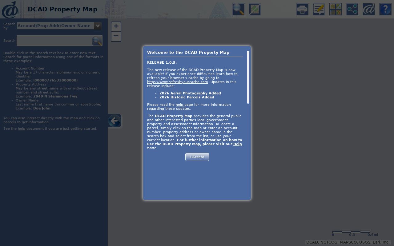
The CAD map can bridge an address to the parcel record, where a result should be logged as an assessed-owner record rather than a household conclusion.
For the Denton portion of Carrollton, the Denton Landmark Interactive Map offers parcel and cadastral context, landmarks, cemeteries, markers, and map layers. Its browser control inventory was not captured in the research, so do not assume a particular buffer or selection tool is available until the live map is rendered.
Map the Block Around Carrollton Neighbors
Use a short parcel worksheet for each address instead of copying names into a general list. The worksheet should identify the target address, adjacent address, parcel or account ID, legal description, county, CAD owner, mailing address, situs, visible exemption, deed instrument and date, map layer, and source URL. This makes it possible to see what the record actually says and to revisit the custodian when a parcel is split, changed, or held by an entity.
- Locate the target address in the county map and save the parcel account or property ID with the county name.
- Click or visually inspect the polygons that touch the target parcel. Note parcels across an alley or street separately.
- Open each adjacent CAD card and compare owner, mailing address, situs, legal description, tax year, and public exemption information.
- Search the correct county clerk index for the deed or plat when an ownership transfer or lot-and-block question needs confirmation.
- Use CityServe only for address-specific permit, planning, or code context, and preserve a case or application number where public.
For a full named-street sequence rather than the immediate block, use the Carrollton street directory. The street workflow follows address-keyed records along a road; the block workflow stays focused on adjoining parcels and their documented relationship to the target lot.
Carrollton Neighbors Cross County Lines
A Carrollton street can lead to Dallas, Denton, or Collin County systems. The city’s three-county geography is more important than the postal city when an owner card, deed, court file, or voter registrar is needed. Start with the CAD or city map to determine the parcel county. Then use that county’s clerk, tax, and election route. A record found under the same name in another county may concern a different person or parcel.
Denton and Dallas provide browser-based official-record indexes, while the Collin County Clerk warns that its online land database is not the official repository. For a Collin-side block, a counter or request for the official instrument can be the right confirmation path. Carrollton city maps supply municipal geography, including planning, election, parks, schools, and public-safety contexts, but their stated accuracy limit means the county parcel layer remains essential for boundary work. For city-held map or permit material that is not online, a defined written request under the Texas Public Information Act, Texas Government Code Chapter 552, gives the department, address, date range, and record type without asking the city to create a new analysis.
Note: City, postal city, county, precinct, subdivision, and parcel are separate fields worth recording for every block result.
Carrollton Neighbors and Voter Data
Texas My Voter Portal can help verify one person’s registration status. It is not a casual map-wide list of Carrollton neighbors. A fuller voter file is a formal SOS request that can be narrowed by county and precinct. Form PI requires a notarized affidavit, a $75 deposit, and a choice of county, precinct, district, and voter-status categories. The SOS says the file is furnished no later than the fifteenth day after receipt under Election Code Section 18.066, subject to payment and applicable rules.
Public election information does not reveal ballot choices. Protected residential addresses, Social Security and driver-license identifiers, and certain voter information are withheld under Texas Election Code protections. ACP participants and specified protected officials may be masked, absent from ordinary displays, or represented through separate confidential procedures. A person’s public status record belongs in a research log as an independent check, not as proof that every person at the address is a neighbor.
Carrollton Neighbors Association Contacts
Community organizations add a useful contact layer to a block search, but they do not provide an open resident directory. Carrollton’s Neighborhood Partnership Office supports organized associations and a nine-member Neighborhood Advisory Commission. The city’s sign-topper guide says a qualified association must be inside city limits, register annually, have existed for at least 10 years, include at least 30 residential units, and provide one-third of sign costs through sweat equity or donated funds. The named representative route is community.development@cityofcarrollton.com.
| Association or resource | Publicly described area or status | Public contact information |
|---|---|---|
| High Country Neighborhood Association | Between Josey and Furneaux, Rosemead and Branch Hollow/Arbor Creek; described as voluntary | Public association contact; no member roster located |
| Woodgate Neighborhood Association | 277-home North Carrollton community with meetings, bylaws, block captains, and community pages | Public site and links; no open roster located |
| Arbor Creek Phase IV HOA | Association with mandatory membership, annual dues, annual meeting, and social group | Public events and contact route; member directory not located |
| Country Villas Homeowners Association | Southeast Carrollton townhomes and single-family area with clubhouse, newsletter, and board contact | Public board, newsletter, and contact route; no public roster |
| City Neighborhood Partnership and NAC | Citywide support for organized associations | Annual registration and city representative, not a resident list |
These differences matter. A voluntary neighborhood association, a required association, and a city partnership program can all have public names and boundaries, but none establishes that a named person currently lives within that boundary. Use the contact structure for civic questions and obtain person-specific verification from the proper public custodian.
Carrollton Neighbors: Official Versus Compiled Data
Official records identify their source, county, date, and limitations. Compiled neighbor tools can combine property, directory, and marketing data, but entries may be stale or join the wrong names. An official source is still limited: CAD lists an assessed owner, not a complete household; a map shows adjacency, not a social relationship; a voter result has confidentiality exceptions; and an association page describes its own public contact structure.
| Source type | Strength | Limit to state plainly |
|---|---|---|
| County CAD, clerk, and GIS | Named custodian, parcel key, legal and recorded fields | Owner and parcel data do not identify every occupant. |
| Texas voter and city records | Defined statutory and departmental access route | Protected data, sealed material, and scope limits apply. |
| Association contact pages | Direct civic contact and stated organization details | Boundary or event information is not membership proof. |
| Compiled public-data category | May offer a quick lead across sources | Can be old, duplicated, or wrongly matched; confirm with the custodian. |
Source view: the Denton County tax search is a public county route for owner or property-location questions on the Denton side of Carrollton.
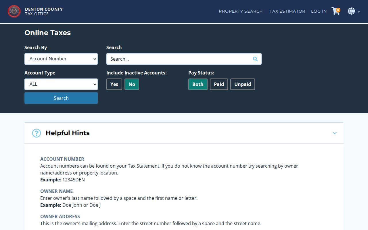
The tax search is strongest when its account, owner, mailing, and property-location fields are compared with the GIS parcel and county clerk record.
Carrollton Neighbor Lookup Privacy Limits
Several kinds of block information remain private: non-owner occupants, household members, utility and delivery customers, protected voter addresses, sealed court parties, school-student information, DMV address and vehicle data, and private association lists. Texas Address Confidentiality Program participants can use a substitute address, and separate voter protections apply to specified people. A parcel boundary, a public owner name, or an association boundary does not permit a searcher to expose information that the source has kept protected.
If a county card, clerk index, or city record needs correction, contact the office that created it and provide the account, instrument, case, or request number. For a map that appears stale, ask the county or city custodian for the current authoritative data. Preserve source dates and state results precisely, such as “adjacent parcel owner according to CAD” or “association contact page,” rather than claiming a person lives at a particular address.
Lawful use. Use Carrollton neighbor records for a focused personal, civic, family-history, or safety question. Never use them to stalk, harass, intimidate, or expose a protected person.