
Tracing a Carrollton Street Directory
Street-by-street research is a chain of address-keyed records. Start with the physical address, locate the parcel, and record the county before looking for a person. CAD can show the assessed owner, mailing address, situs address, and legal description. GIS shows the parcel’s position and adjoining lots. The county clerk index uses the owner name and legal description to find recorded transfers. Voter status and old criss-cross directories are separate checks, not substitutes for the parcel trail.
A Carrollton street may be in Dallas, Denton, or Collin County. A ZIP code or postal city does not settle that point. Preserve the account or property ID with the exact address because it connects an appraisal search to map and deed work. If a unit is involved, search with and without the unit number. Older documents may show only the lot, block, subdivision, or abstract.
- Normalize the number, direction, street name, suffix, unit, postal city, ZIP, and likely county.
- Find the parcel in the county CAD or tax system and copy the owner, situs, mailing address, account ID, and legal description.
- Use the county GIS or CAD map to inspect the parcel and the nearby street segment.
- Search the current owner as grantee in the county clerk index, then use the seller as a grantee to move back through the chain.
- Test a named match through voter status or a dated criss-cross directory, with privacy and coverage limits in mind.
Carrollton Street Address Normalization
Normalize first because each Carrollton address system has its own search habits. Denton taxweb treats property location as the physical address and tells users to omit the street type and direction, such as using a number and street name rather than an added suffix. Its owner-address field instead means the mailing address. Dallas CAD supports street-address and map modes. Collin CAD can narrow a street query with street number, street name, subdivision, neighborhood, tax year, and legal description.
A physical address can change in presentation while the legal description persists. For historical work, copy the subdivision, lot, block, abstract, or survey text from the parcel card before searching the clerk. In early Carrollton material, Town Square, railroad, farm, church, school, and addition references may appear instead of a modern street number. The city’s growth began before today’s suburban grid, so never silently treat two similar numbers as the same place.
Note: The city’s official sources did not locate a verified citywide renumbering year, so bridge old and current addresses with plats, landmarks, and legal descriptions.
Carrollton Street Directory CAD Fields
Use the appraisal search as the modern address layer. The CAD card can expose a property ID, owner name, owner mailing-address lines, situs address, legal description, acreage, block or lot, exemptions, land and improvement values, sales or deed history, and map links. The list is evidence about the assessed parcel. It does not list every person who occupies a home, and a tax mailing address may be somewhere else.
| Carrollton CAD search field | Where it appears | Street-search use |
|---|---|---|
| Owner name | Denton, Dallas, and Collin systems | Starts a deed-index query and identifies an entity or trust name. |
| Street address or property location | Dallas street mode; Denton property-location hint | Finds the physical parcel, not just tax correspondence. |
| Account or property ID | CAD result and map systems | Holds the result steady when a street string varies. |
| Subdivision, lot, block, legal description | CAD fields and Collin advanced search | Bridges a street record to plats and older deeds. |
| Tax year or neighborhood | Collin advanced search | Narrows a large address result without claiming occupancy. |
Collin CAD’s advanced property search is the proper county route for the small Collin County portion of Carrollton.
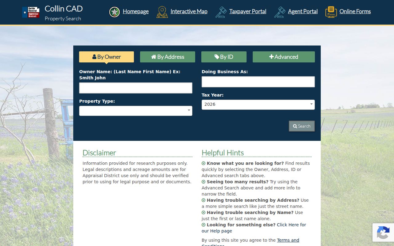
The Collin interface includes filters beyond an address, but its appraisal-use legal descriptions and acreage still need verification before any legal conclusion.
Carrollton Street Results in Dallas CAD
For a Dallas County-side address, Dallas CAD offers Find by Owner, Account, Street Address, Business Name, and Map. The owner search asks for a full last name plus at least two first-name letters. The map permits an account number, property address, owner-name search, or map click. Use the street-address route to reach the parcel first. Use an owner search only after the parcel gives a name to test.
Dallas CAD’s street-address search offers the address-focused modes available for a Carrollton parcel.
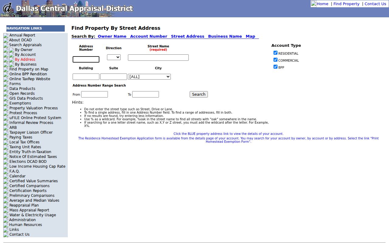
The address, account, and map modes are useful for the same parcel at different stages, while the county field remains necessary for routing a deed request.
Dallas CAD owner search supplies the name-first route after an address result has produced an assessed owner.
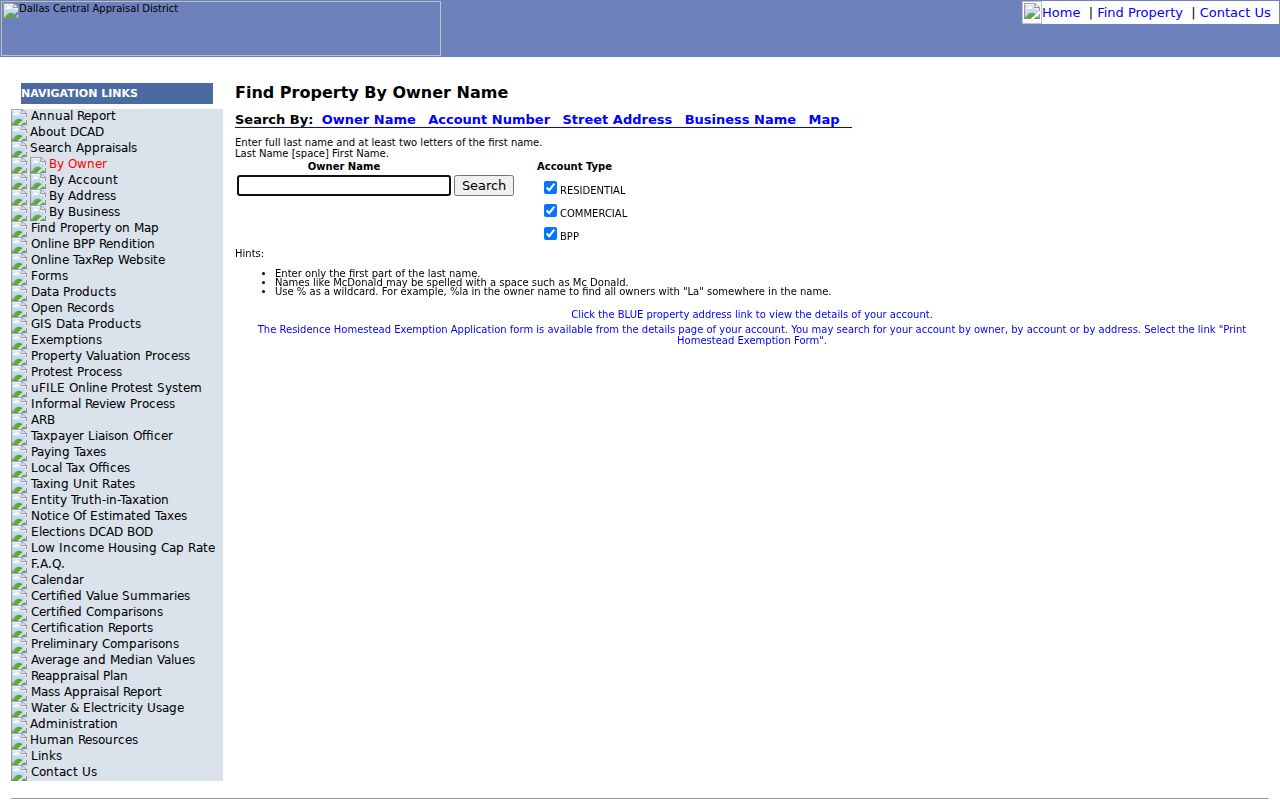
Owner-name results should be treated as assessed-property evidence. Compare the situs, account, and legal description before tying a similarly named owner to the street address.
Carrollton Street Parcel Maps
GIS is the visual bridge between a street and the property record. Denton County Landmark users can zoom, switch between aerial and traditional views, and inspect landmarks, cemeteries, markers, and general histories. Denton’s GIS hub also describes public layers for parcels, political and municipal boundaries, voter precincts, transportation, floodplain, and other geographic features. Dallas CAD map results link back to the property record. Carrollton city maps add planning, zoning, election, and parks-and-schools layers.
Clicking a polygon does not prove title or current occupancy. It establishes a map relationship. Open the CAD account to compare the situs, mailing address, legal description, tax year, and exemption signal. Then use the county clerk’s deed or plat index for the recorded chain. When a map looks stale, compare the latest CAD account and plat or ask the city or county records officer for the authoritative data file.
Carrollton Street Directory Deed Chain
The deed chain supplies the recorded ownership layer behind a Carrollton street directory search. From the CAD card, search the owner as grantee in the correct clerk index. Save the instrument number, recording date, grantor, document type, and legal-description text from the acquisition record. Next, search that seller as a grantee to find the earlier acquisition. Continue only while the legal description, lot or block, acreage, or plat connection stays consistent.
Denton’s official records search accepts a Search Term, recorded-date range, date presets, and index-only or index-plus-full-text OCR choices. It can search grantor or grantee names, subdivisions, document types, and document numbers. The official portal displayed certification through September 2, 2021 when researched; a separate coverage lead suggests a full index beginning May 12, 1854 and plats from January 1, 1900, but current coverage and images should be confirmed with the county.
Denton County Official Records Search shows the quick-search controls used for a north or west Carrollton address.
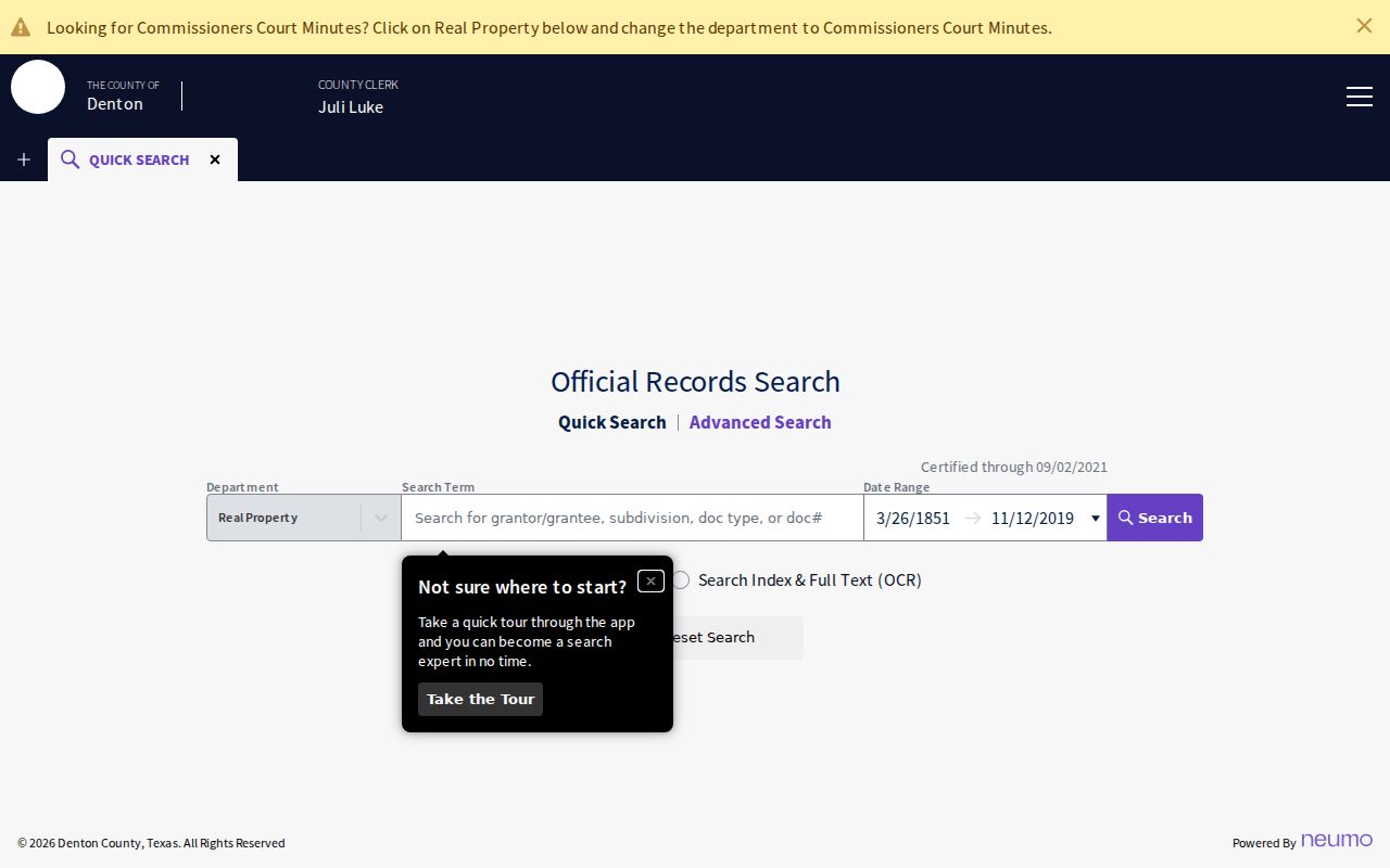
OCR can find a party or legal-description phrase missed by ordinary indexed fields, but it can also return false hits, so inspect the county, instrument, and parcel continuity.
Carrollton Street Records in CityServe
CityServe is Carrollton’s municipal, address-keyed layer. Its menu includes building and planning applications, code complaints, contractor search, environmental-quality material, and property information. A permit or application can connect a site address with an application or permit number, type, status, applicant or contractor, and date fields where public. A code case marks a reported municipal issue at a site. Neither result proves that a named person resided there.
The public text does not publish a complete index start date, all live search fields, or a historic permit cutoff. When a browser search does not reach the record needed, use the City Secretary’s written public-record request route. Identify the address, department, record type, date range, and desired format. The CityServe portal is the city’s JavaScript-based access point.
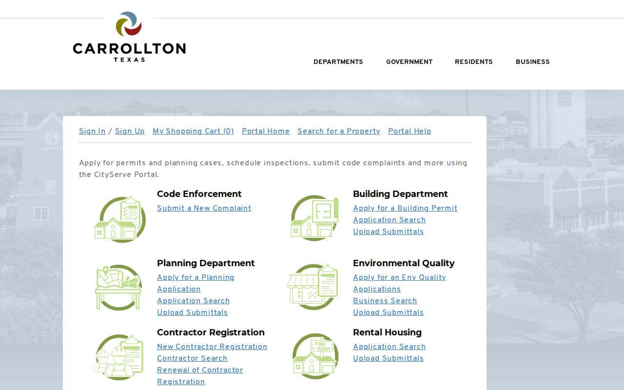
Use a CityServe result as an address event in the record chain, then confirm its public status and date with the city custodian if a record matters.
Carrollton Street Directory Coverage
Each address source has a different key and coverage limit. A careful by-street search moves from the location record to the recorded transfer, not from a single name result to a conclusion. Use the table to select the office and fallback channel that matches the question.
| Address-keyed Carrollton record | Key used | What it may show | Access route |
|---|---|---|---|
| CAD or tax account | Situs, owner, account, legal description | Assessed owner, mailing and property address, values, exemptions | County-specific free portal |
| GIS parcel map | Map click, address, account | Parcel boundaries, layers, adjacent parcels, district context | County, CAD, or city viewer |
| Deed and plat index | Grantor, grantee, instrument, legal description | Transfers, dates, subdivision and lot/block context | Clerk portal, counter, or copy request |
| Voter status or file | Name, county, VUID or precinct | Public registration status and precinct data where permitted | SOS lookup or statutory file request |
| CityServe | Site address or application | Permit, planning, contractor, or code event | Dynamic portal or City Secretary request |
| Criss-cross directory | Street number and street name | Historical address or subscriber clue in a dated edition | Library, archive, or microfilm |
Denton supports online and copy-request channels. Dallas retains online record, clerk, and court-record routes. Collin says its online land database is not the official repository, making a property-record request or counter copy important. That channel difference matters as much as the screen result.
Carrollton Street Voter Evidence
Texas My Voter Portal is person and status oriented. It can help evaluate a named person in a county and may return public registration status, precinct, district, or address information where allowed. It does not provide a casual household roster for an entire street, and it never reveals ballot choices. Protected voters, including Address Confidentiality Program participants and specified officials, can have masked or substitute address treatment.
A bulk voter-file request is a different process. The SOS Form PI supports county and precinct selection, active, suspense, and cancelled categories, a notarized affidavit, a $75 deposit, and zipped fixed-width delivery by CD-ROM or FTP. The state says the file is provided no later than the 15th day after receipt under Election Code §18.066, subject to payment. Use that route only for lawful research and describe any result as a voter record, not as a complete list of residents.
Carrollton Street Directory History
Reverse or criss-cross directories are the historical address layer. Find the street guide or address section, locate the number and street, then verify the resulting name in the alphabetical section. Edition keys can use initials, spouse notation, publisher marks, and abbreviations that change by year. Dallas Public Library’s Dallas History & Archives is the closest documented repository for Texas city, telephone, and criss-cross directories in print and microfilm. Exact Carrollton runs must be confirmed with the library catalog or staff.
The Carrollton Chronicle can bridge missing directory years. UNT currently lists 2,511 issues and 17,512 pages from 1904 through 1967, although a library announcement described a larger 1904–1994 microfilm project. Search a street, nearby landmark, spouse name, or business along with a surname. A directory or newspaper item dates a clue. It does not independently establish every member of a household.
Carrollton Streets Before the Grid
Carrollton’s older address evidence reflects a railroad and town-square history. The first post office opened in 1878, the railroad arrived in 1879, the Myers plat shaped the Town Square in 1900, the Frisco line arrived in 1903, and the interurban began service in 1922. Older deeds, notices, and newspaper items can therefore use depot, square, church, school, farm, railroad, survey, or addition references instead of a current street string.
That history is a practical search tool. When a modern address fails, return to the CAD legal description and look for the lot, block, addition, or abstract. Search old landmark terms in a county deed index and the Chronicle, then use a plat or Sanborn sheet to connect the older reference to a modern parcel. The research did not verify a citywide street-renumbering chronology, so the link must remain explicit and sourced.
Carrollton Street Directory Terms
Address research crosses several systems. These terms help keep a parcel observation, a record entry, and a resident claim separate.
- Parcel
- A mapped piece of land tied to an account or property ID. A parcel can be vacant, jointly owned, or held by an entity.
- Situs address
- The property’s physical location used by appraisal, GIS, permit, and code systems. It differs from a tax mailing address.
- Plat
- A recorded map that shows a subdivision, lots, blocks, easements, and street layout, connecting legal text to a place.
- Criss-cross directory
- An address-first directory section used to find a historical occupant or subscriber before checking the alphabetical listing.
Carrollton Street Directory Limits
An address search cannot reveal a complete household. Non-owner occupants, utility and delivery customers, school-student records, private association members, protected voter addresses, and motor-vehicle address data are not made public by the property chain. A homestead claim is an exemption clue, not a list of people at the address. A map line between parcels is spatial evidence, not a social or family relationship.
Texas Public Information Act requests under Texas Government Code Chapter 552 can seek defined existing city records when the portal does not expose them. Direct the written request to the correct public-information officer and name the address, department, date range, record type, and desired format. The law does not require the city or county to create a new resident analysis from its systems.